Olex mjukvara, Software Mjukvara
Product Number:
OX3
In stock
SEK 56 306,25
Unitprice with VAT
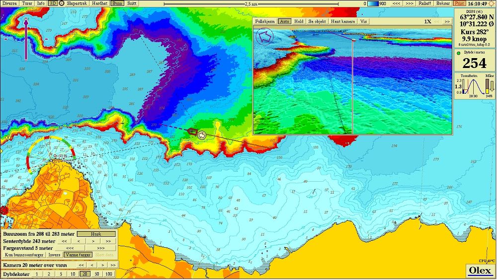
Olex is a uniqe system for navigation and charting, developed by the Norwegian company Olex AS. Olex is used in combination with single- and multi-beam sounders to map the seabed for fisheries, aquaculture, and maritime contracting. In addition Olex holds all necessary functions and tools for safe navigation and fishery plotting.
Olex software consist of three main elements:
Functions for sea floor mapping.
Navigation, and display of digital vector charts.
Plotting functions
Olex calculates a sea floor map using data from GPS and echosounder. For each new measured depth, the map improves. The survey takes place automatically and requires no operation.
The sea floor map can display in 2D with contour lines or relief, and in 3D with a virtual camera which can be used to
OX3_BROSCHYR.pdf (2.3 MB)
Print PDF