Ytre Sula-Værøy-Dalsfjorden 2015
Product Number:
NBOAT12
In stock
SEK 550,01
Unitprice with VAT
Perfect for planning and navigation at sea.
Updated: 2014
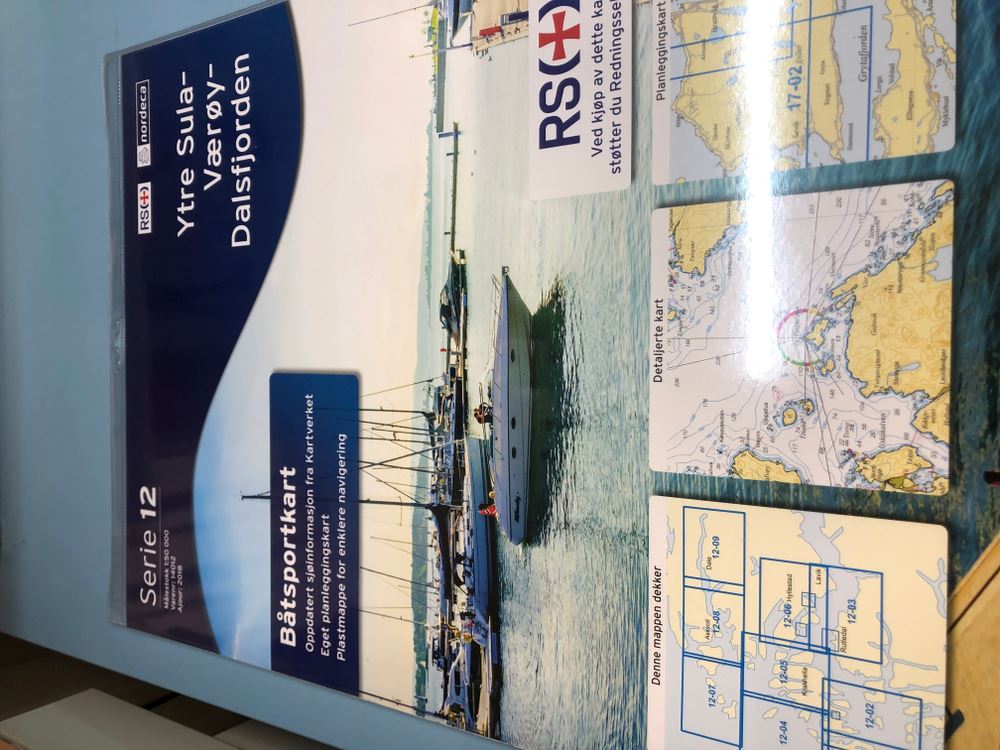
The map covers from Sula in the south to dais in the north, as well as the archipelagos outside. Map portfolio consists of 9 different maps, in size 35 x 45 cm, which overlap. These come in a great plastic folder that you at any time can have four adjacent map sheets visible for easier navigation and maps give extra protection against rain and spray Each folder also comes with one overview map that shows which map sheets covered by the relevant map folder
Updated: 2014
The map covers from Sula in the south to dais in the north, as well as the archipelagos outside. Map portfolio consists of 9 different maps, in size 35 x 45 cm, which overlap. These come in a great plastic folder that you at any time can have four adjacent map sheets visible for easier navigation and maps give extra protection against rain and spray Each folder also comes with one overview map that shows which map sheets covered by the relevant map folder